Log in
All resources
Create a design
468 Free Artworks of United States Map
maps in the library of congress
cornell: persuasive cartography: the pj mode collection
old maps of the united states
cornell university library
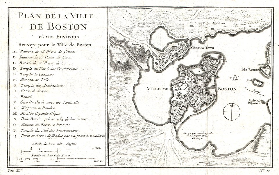
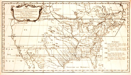
french-language maps of the united states
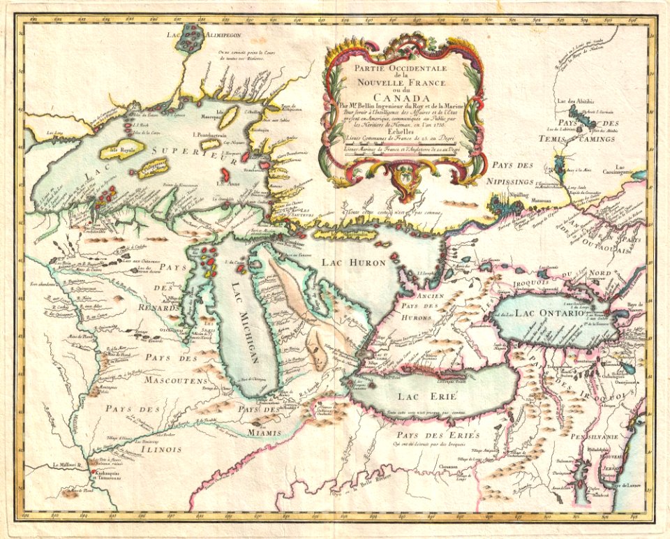
old maps of canada from the norman b. leventhal map center
old maps of the united states from the norman b. leventhal map center
curt teich postcard archives
map postcards
maps by willem and johannes blaeu
english-language maps
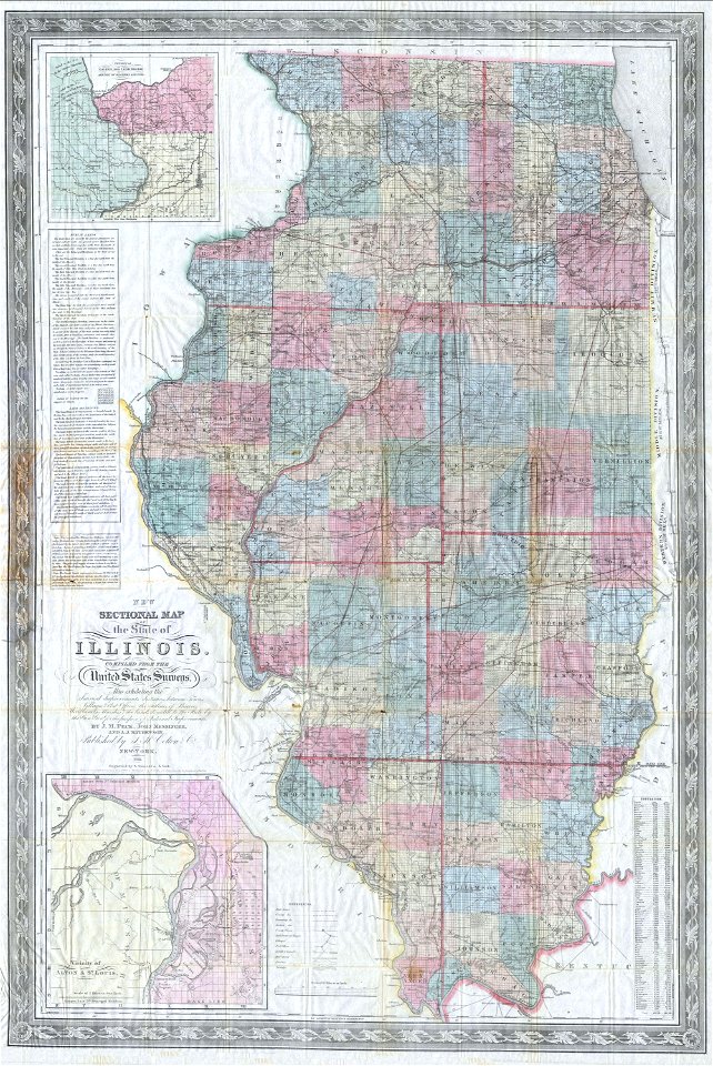
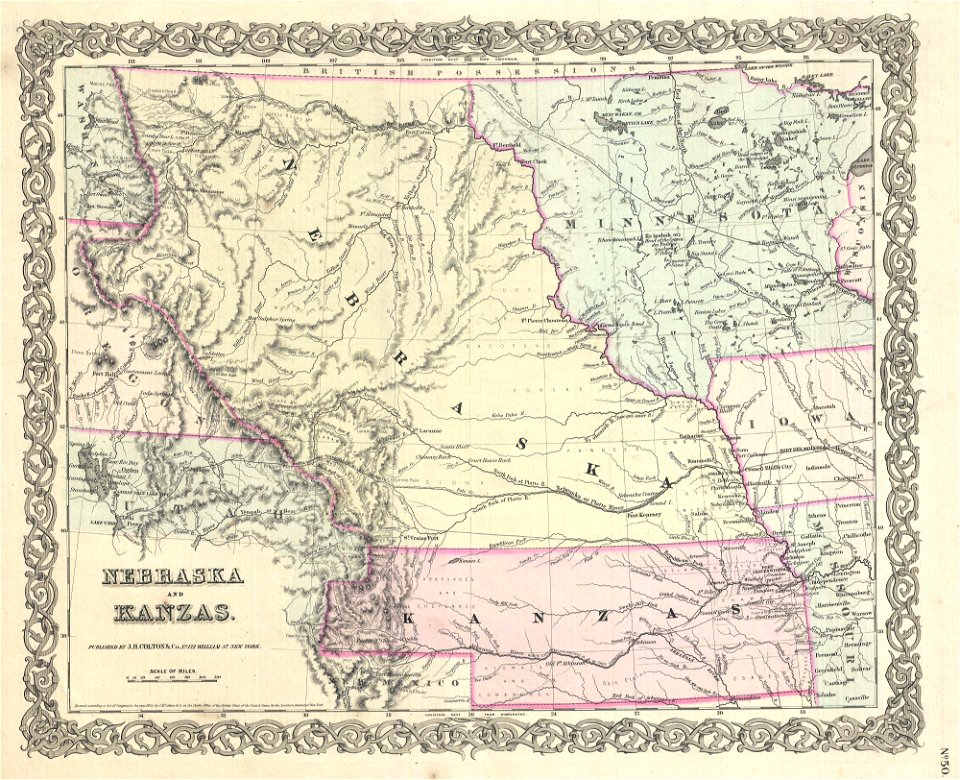
missouri
old maps of new york (state)
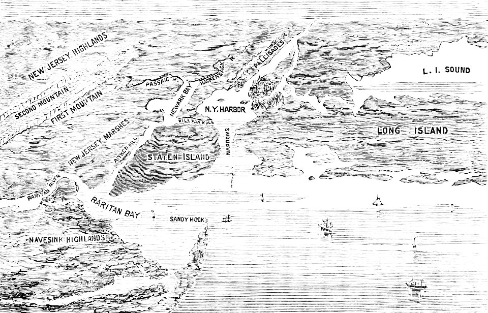
the palisades (hudson river)
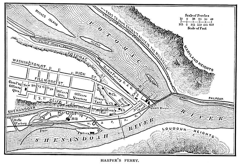
harpers ferry
west virginia
map images supported by wikimedia uk
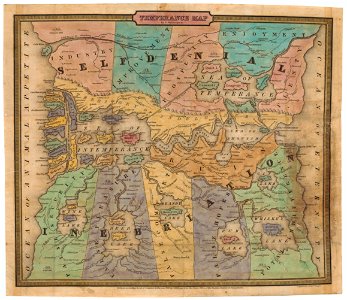
1856 maps
maps of okinawa islands
maps of guam
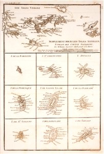
maps by jacques-nicolas bellin
jacques-nicolas bellin
maps by jacques-nicolas bellin
jacques-nicolas bellin
old maps of the united states
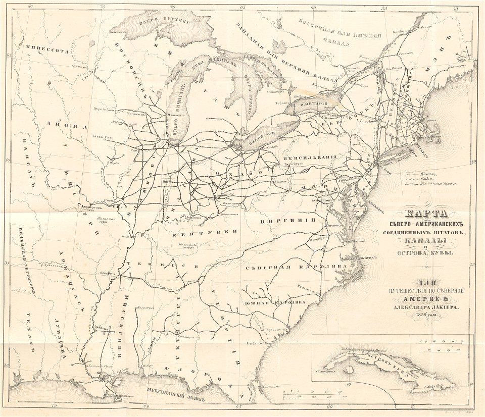
1859 maps
johann baptist homann
latin-language maps
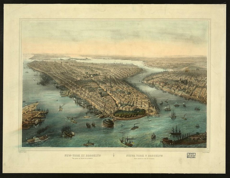
new york city
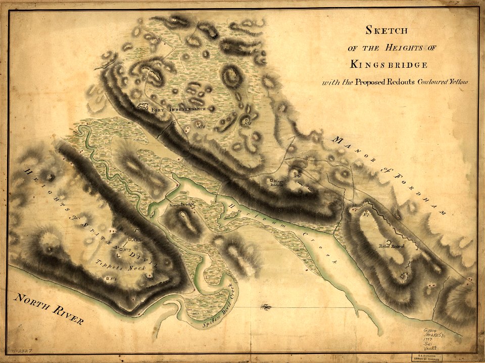
bronx
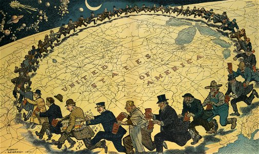
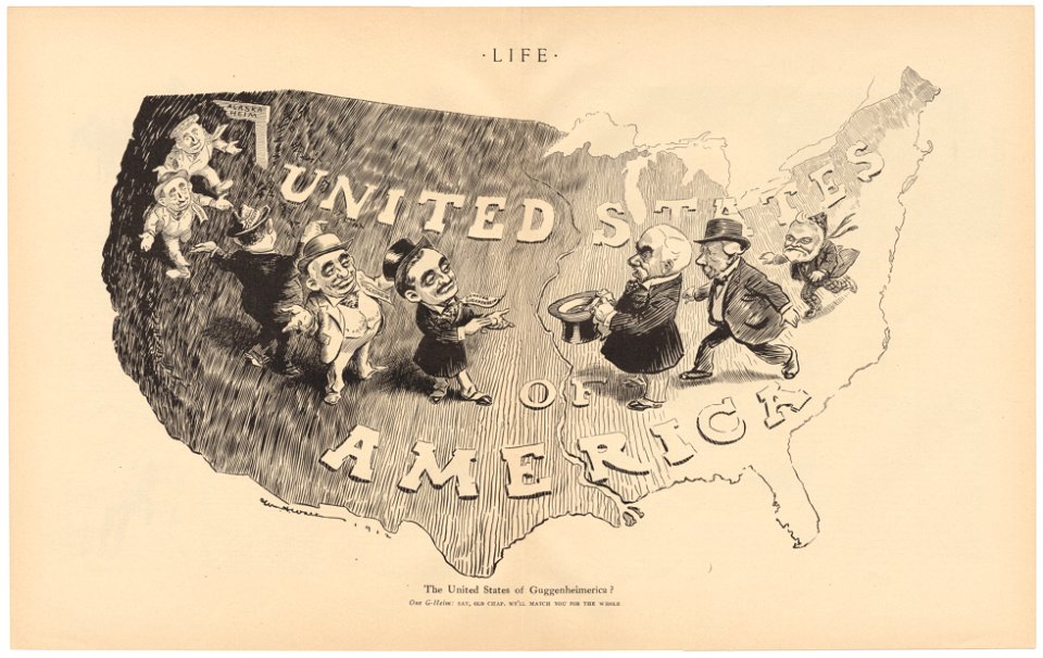
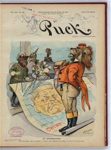
puck
1910
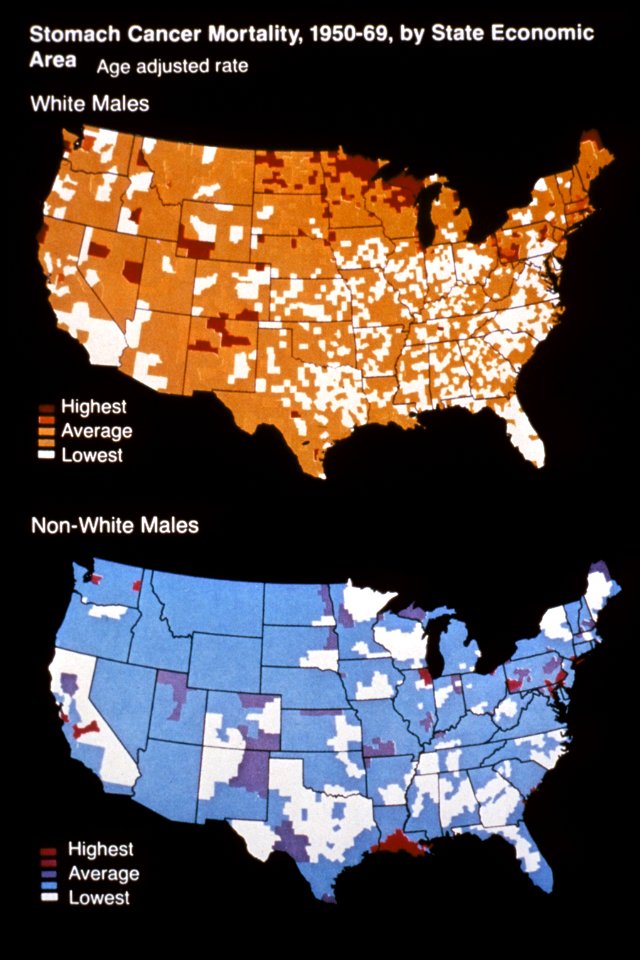
media from national cancer institute visuals online
maps of the united states
military bases of the united states
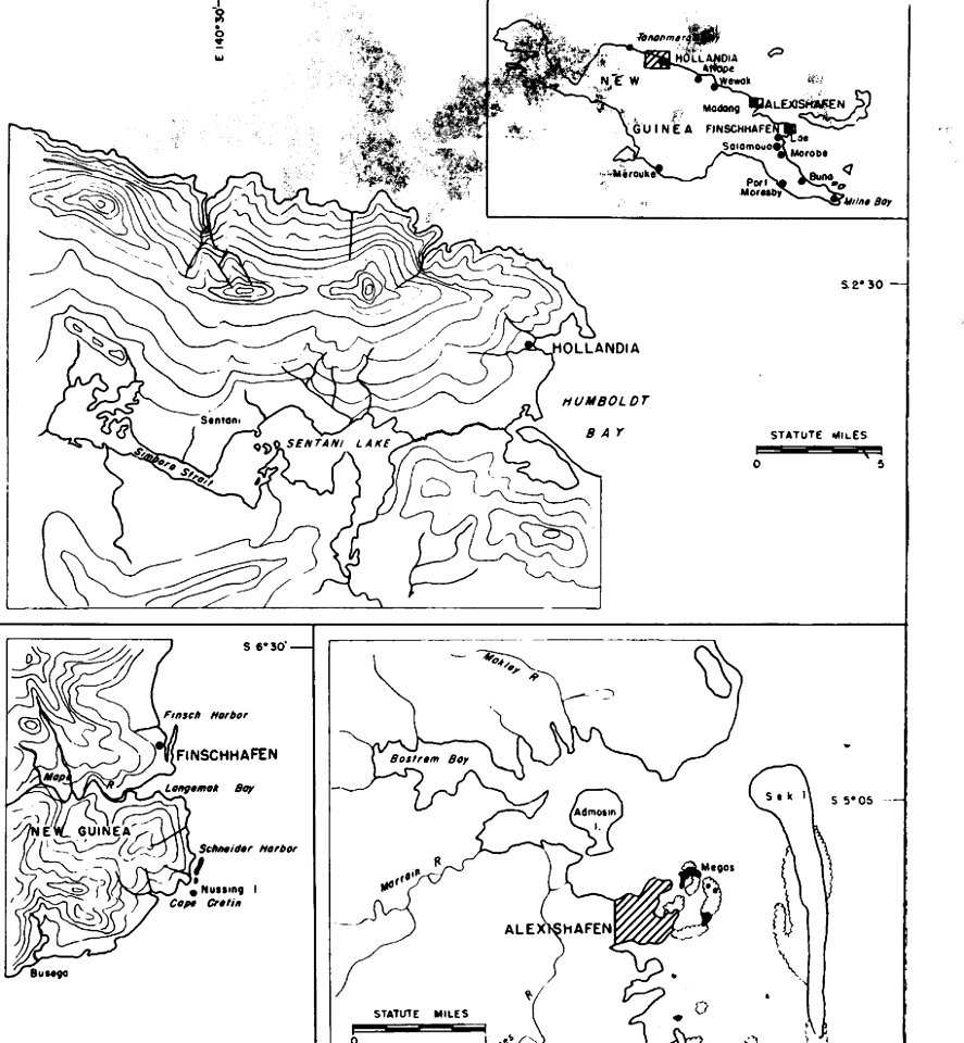
old maps of papua new guinea
mercator projection
sugar industry
19th-century lithographs in the united states
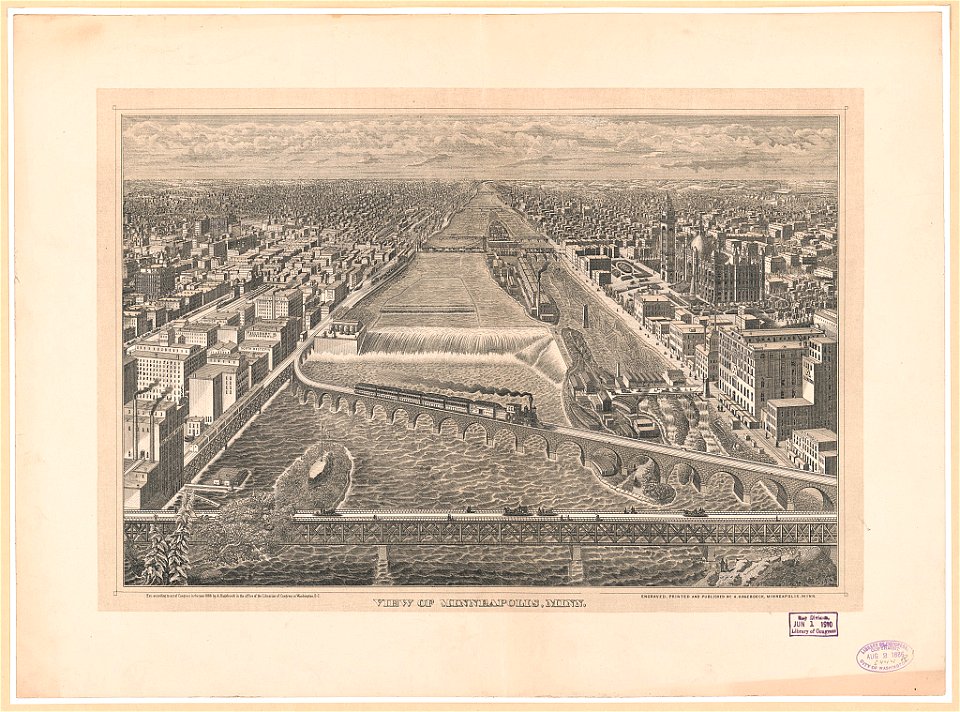
mississippi river at minneapolis
maps by samuel de champlain
history of north america
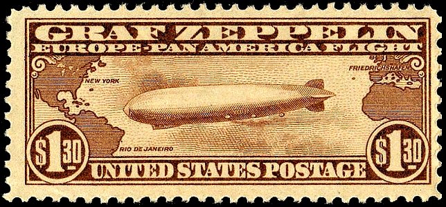
1934 stamps of the united states
blue stamps
1780 maps of pennsylvania
1780 maps of new jersey
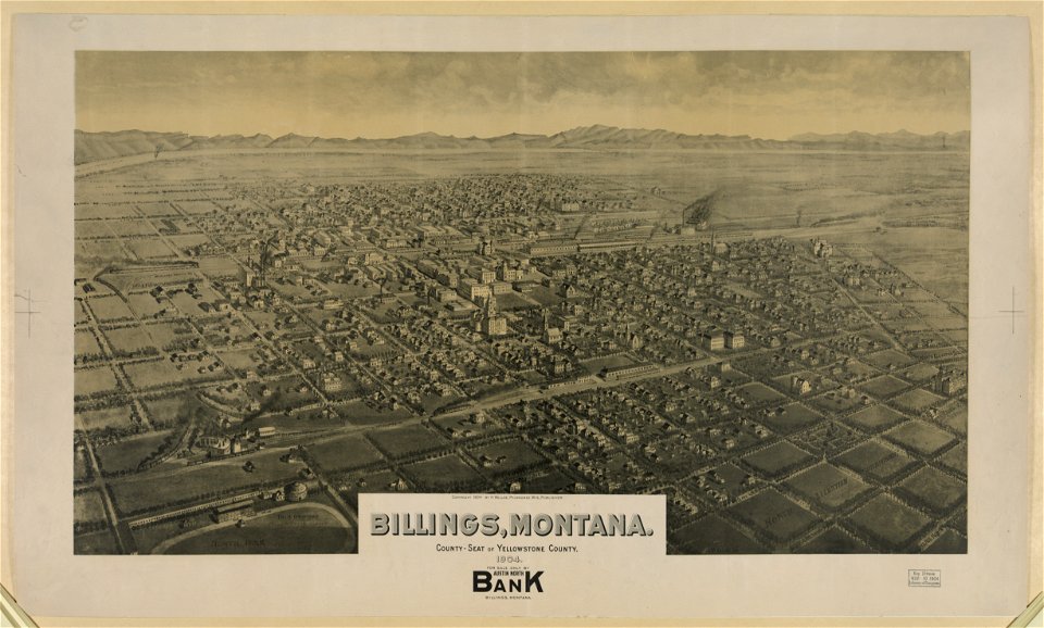
lithographs of montana
montana
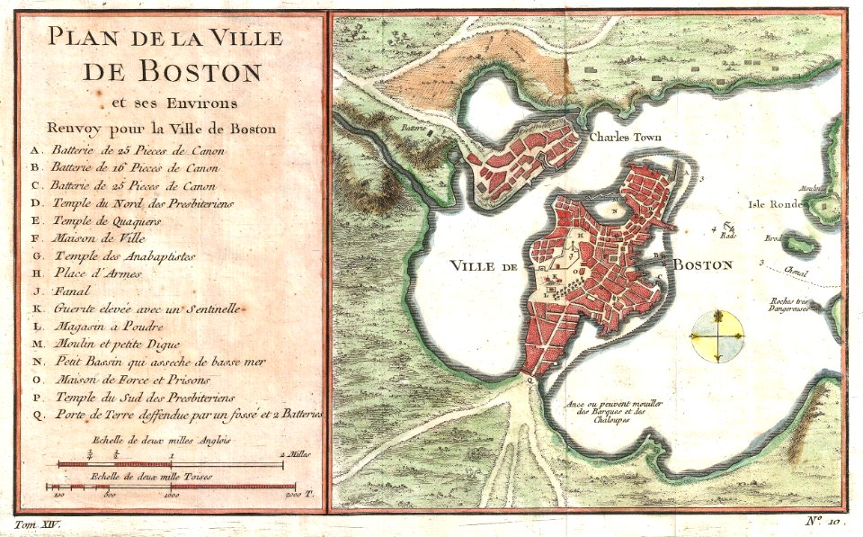
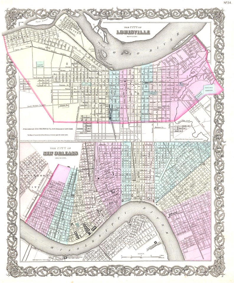
louisville,
kentucky
airmail stamps of the united states
brown stamps
maps in the library of congress
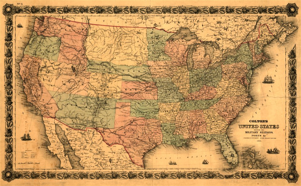
1861 maps
maps in the library of congress
1861 maps
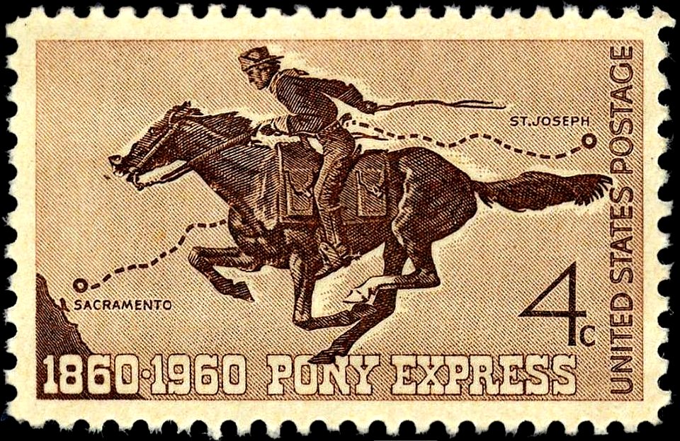
pony express stamps
pony express
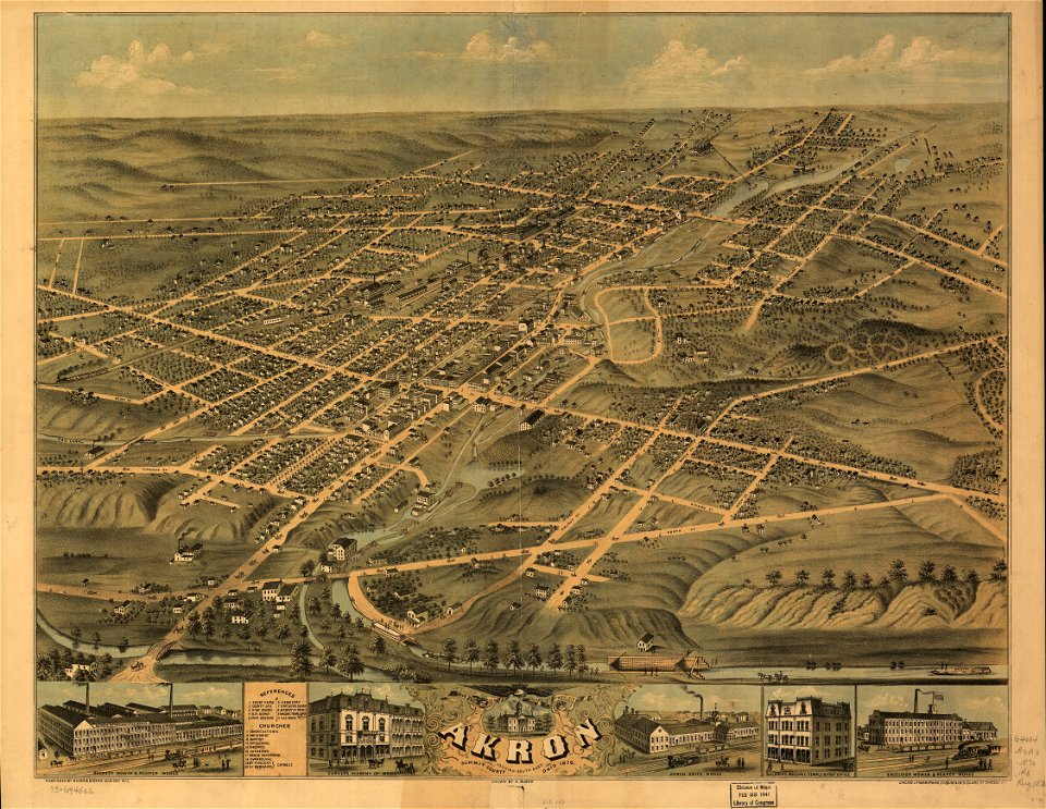
akron
ohio
cornell university library
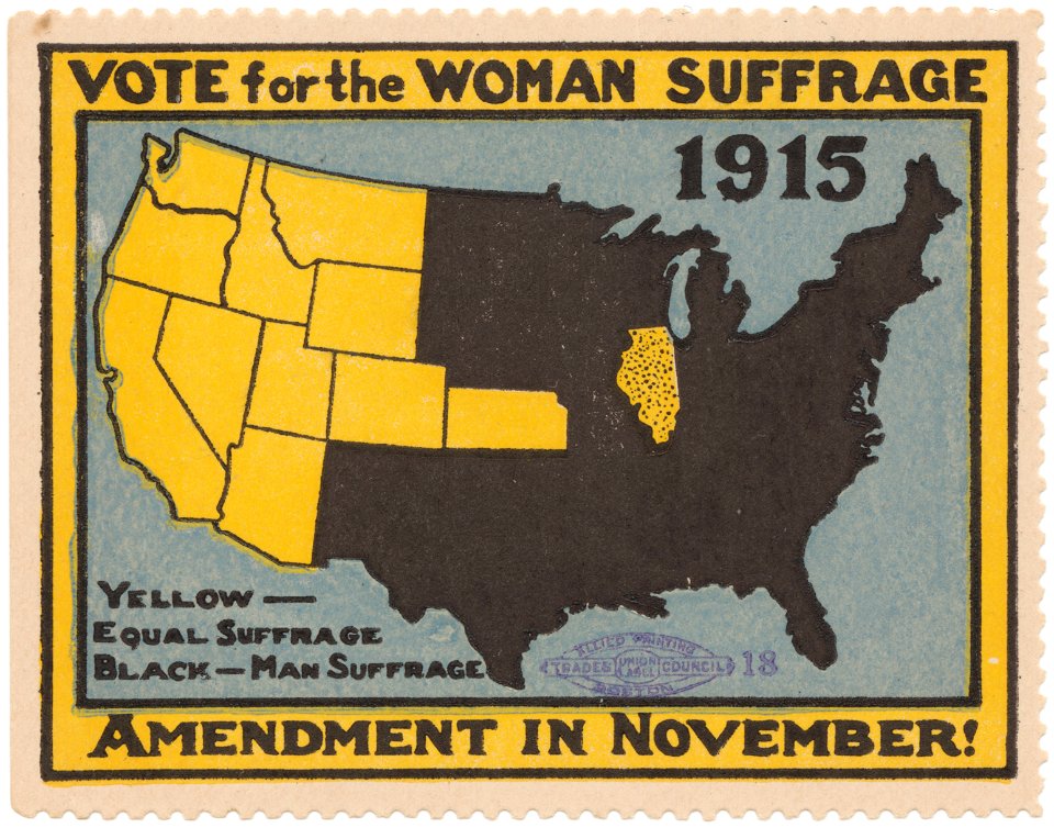
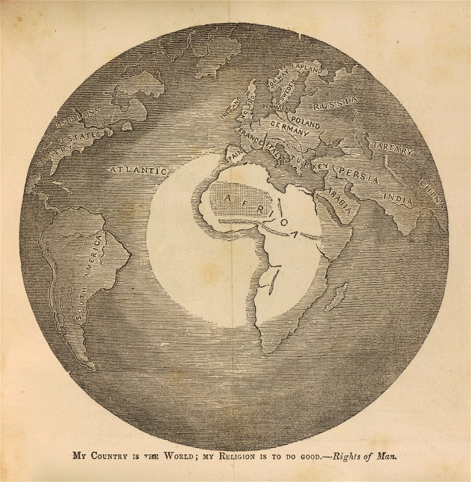
women's rights
map images supported by wikimedia uk
1856 maps
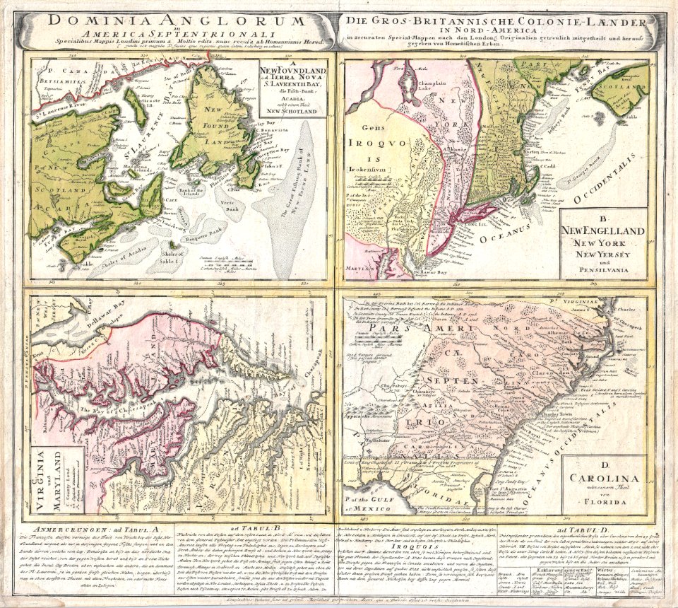
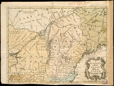
18th-century maps of north america
1794 maps
old maps of north america
1755 mitchell map
old maps of north america
1755 mitchell map
old maps of north america
1755 mitchell map
cornell university library
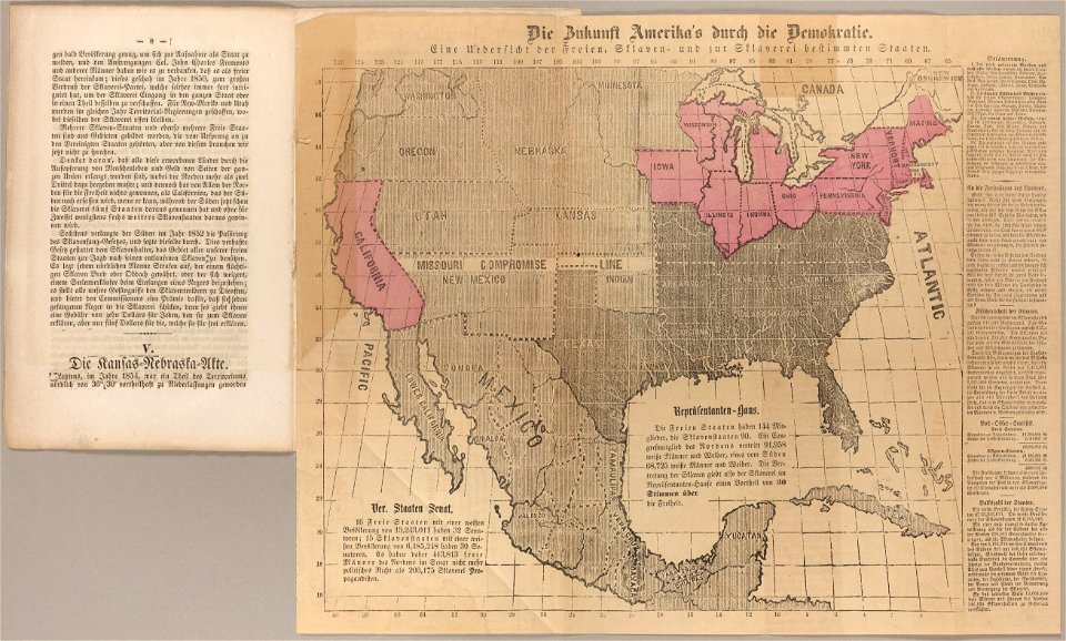
abolitionism
19th-century maps of the united states
volume 1 of le tour du monde
indian territory
franklin pierce
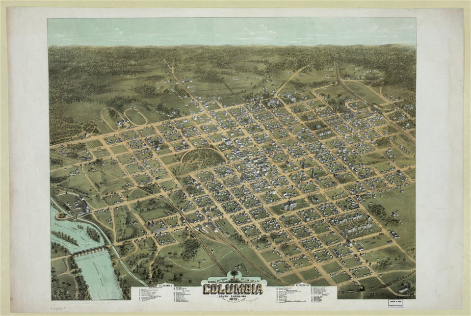
south carolina in the 19th century
columbia
south carolina in the 19th century
columbia
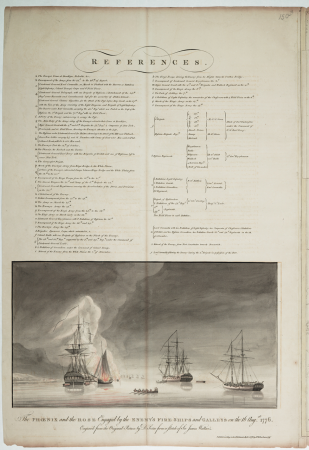
illustrated battles of the nineteenth century
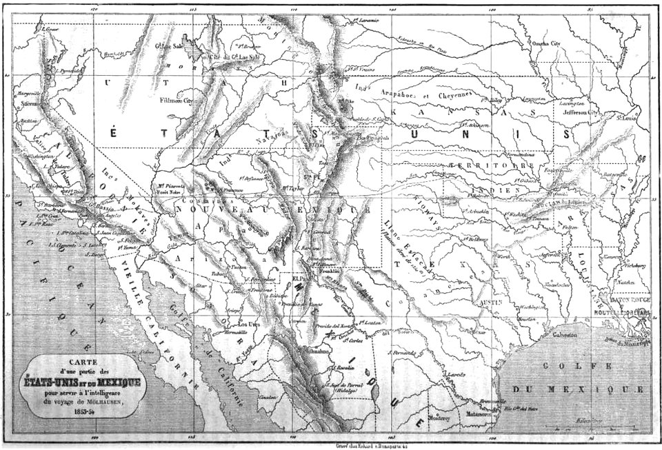
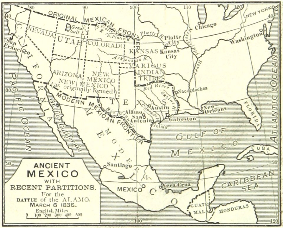
maps of the history of mexico
south carolina
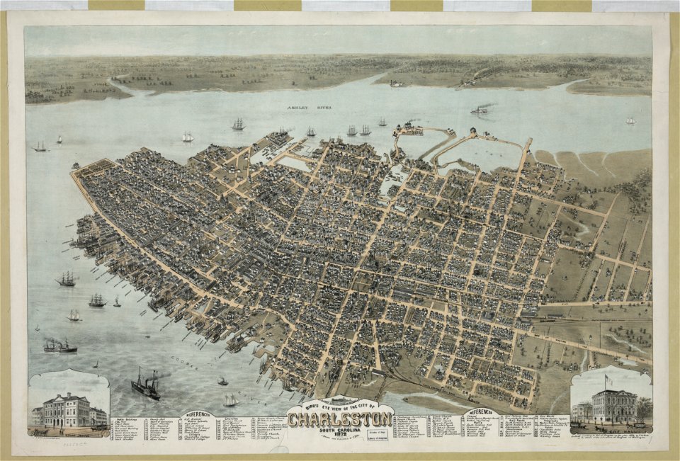
charleston
old maps of north america from the norman b. leventhal map center
1755 maps of the united states
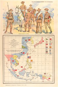
philippine sea
1898
lithographs of cities in the united states
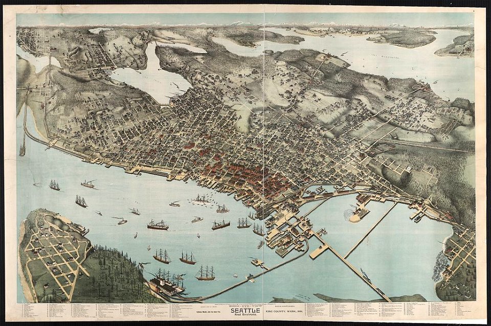
1891 in seattle
iroquois
ontario
life
1912
1780 in the caribbean
virgin islands
cornell university library
jr
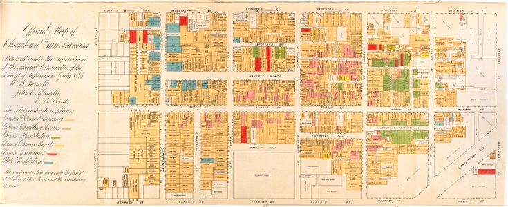
san francisco
chinatown
chromolithograph
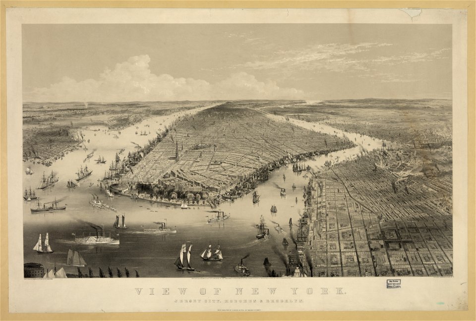
new york city
imperial
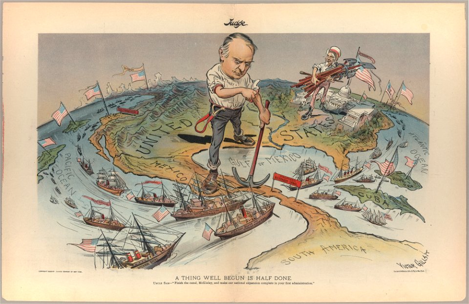
judge
maps by willem and johannes blaeu
hudson valley
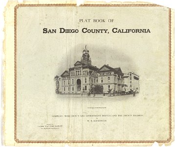
county courthouses in california
california
prints from mémoires des commissaires du roi et de ceux de sa majesté britannique at the peace palace library
old maps of the united states
chromolithograph
currier and ives
cornell university library
thomas paine
cornell: persuasive cartography: the pj mode collection
gerrymandering in the united states
old constellation maps
maps by samuel dunn
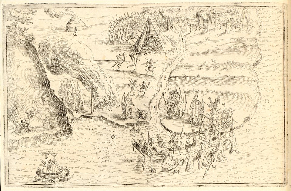
jacques le moyne de morgues
1591
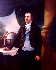
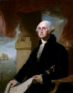
paintings by ezra ames
simeon de witt
1892 in the united states
laredo, texas
lansdowne portrait of george washington
neoclassicism
cadastral maps of the united states
maps of mount vernon
maps of the west-indische compagnie
1800 maps of the united states
maps of the history of the united kingdom
maps of voyages
1895 maps of new york (state)
old maps of albany, new york
media contributed by the frick collection
naïve art
maps of saguaro national park
oro valley
1898 covers of puck magazine
drawings of scissors
maps in the library of congress
adriaen van der donck
st andrew's church (roman catholic, manhattan)
sanborn maps of manhattan published in 1905
maps in the library of congress
1877 in ohio
glaciers and glaciation (1910)
maps of yakutat bay
maps in the library of congress
fortifications of port hudson
16th-century maps of north carolina
theodor de bry
cecil calvert, 2nd baron baltimore
works by gerard soest
1890s maps of the united states
maps of the thousand islands
old maps of the united states
copper engravings
curt teich postcard archives
postcards of texas
1898 covers of puck magazine
drawings of scissors
bird's eye view of knoxville, tennessee, 1886
maps in the library of congress
curt teich postcard archives
postcard collecting
charles frederick cheffins
1841 maps of texas
old maps of the united states
copper engravings
curt teich postcard archives
map postcards
statue of josé gervasio artigas (washington, d.c.)
maps of washington, d.c.
old maps of the united states
sanson maps of north america
lawrence h. slaughter collection of english maps, charts, globes, books and atlases
nypl lionel pincus and princess firyal map division
1777 maps of new york (state)
1777 maps of new jersey
2008 u.s. presidential election maps, democratic primary
2008 iowa election maps
maps in the library of congress
1898 maps of spain
glaciers and glaciation (1910)
hubbard glacier
1747 maps of north carolina
maps by emanuel bowen
curt teich postcard archives
map postcards
old maps of the united states from the norman b. leventhal map center
old maps of canada from the norman b. leventhal map center
19th-century solar eclipse maps
solar eclipse of 1900 may 28
curt teich postcard archives
postcards of muncie, indiana
maps by willem and johannes blaeu
new amsterdam
everett d. graff collection of western americana
cherokee nation
maps by gouverneur k. warren
maps by edwin freyhold
eran laor cartographic collection
daniel friedrich sotzmann
everett d. graff collection of western americana
stephen f. austin
charts and maps of the royal museums greenwich
1778 maps of new york (state)
101 - 200 of 468
Next page
/ 5